





Real Time Updates
Hurricance Isaias makes landfall as Catergory 2
The National Hurricane Center announced that Hurricane Isaias made landfall as a Category 2 storm near Destin at 8:30 p.m. Friday night.
The storm weakened in the final hours before landfall, slowing from a previous 120 mph to 105 mph.
Hurricane Isaias continues to move North out of Okaloosa County at 19 mph, but that does not mean it is safe enough to leave shelter.
Downed trees, power lines, and flooded roads still pose a risk to personal safety.
National Hurricane Center update: 9:00 p.m.
The most recent update from the National Hurricane Center has Hurricane Isaias moving North at 19 mph.
Max sustained winds have decreased to 85 mph.
National Hurricane Center update: 8:40 p.m.
The National Hurricane Center announced that Hurricane Isaias made landfall at 8:30 p.m. near Destin, FL, with sustained winds of 105 mph.
The storm continues to move North, now at 19 mph.
National Hurricane Center update: 7:00 p.m.
Isaias is moving North at a speed of 18 mph. Landfall is expected within the next hour or two.
The Hurricane has slowed and is now declared a Category 2 with sustained winds at 110 mph.
Gulf Breeze recorded sustained winds of 83 mph with gust of 97 mph. Pensacola International Airport recorded gust of 71 mph.
Eglin commander declares HURCON 1E
Col. Chris Keithley, the installation commander, declared Hurricane Condition 1E at 6 p.m. today.
HURCON 1E indicates sustained winds of at least 58 mph and/or gusts of 69 mph, requiring people to shelter or find shelter immediately, and movement outside should be restricted to prevent injury.
The 96th Medical Group Hospital is the designated safe shelter for on-base residents.
The 96th Medical Group Hospital emergency operations, labor and delivery, and inpatient services will remain open. Everyone is advised that the gates are closed as of 1 p.m. today. The 96th Medical Group Hospital Gate can be used for exit-only purposes until the base is reopened. All outdoor activities and non-emergency operations are closed.
All gates will open and operations resume once the base is secure, recovery operations are complete, and the installation commander gives the go-ahead.
People are reminded to follow local county, evacuation orders and city emergency management advisories, bridge closures, and monitor television, radio broadcasts and internet for the latest National Hurricane Center’s forecasts.
For more information, visit www.eglin.af.mil, Eglin AFB Facebook, or call the 96th Test Wing Public Affairs Office at (850) 496-0899.
National Hurricane Center update: 5:45 p.m.
A wind gust of 72 mph was recently recorded at Orange Beach, Alabama. Another was recorded off the coast of Pensacola at 69 mph.
Hurricane Isaias is approximately 70 miles offshore from Pensacola.
Emergency Operations Center update: 4:50 p.m.
Strong tropical-force winds (58- 73 mph) are expected to hit the area around 6 p.m.
Hurricane-force (73 plus mph) winds are expected around 8 p.m.
It is predicted that by 4 a.m., winds will be on the Florida-Alabama border
Road closure
The Florida Department of Transportation has issued that Eastbound I-10 at Mile Marker 54 (near Antioch Road) is closed due to a vehicle crash.
Emergency responders are on-site along with FDOT crews.
It is advised to utilize an alternate route at this time.
National Hurricane Center Update: 4:00 p.m.
As of 4:00 p.m., the National Hurricane Center has released the most recent information regarding Hurricane Isaias.
The storm is no longer shifting toward the East but is now tracking North at 17 mph. Landfall is expected on the Western Florida Panhandle later this evening. The center of the storm is expected to move across Alabama and into the Tennessee Valley Saturday and Sunday.
Isaias has sustained max winds of 115 mph with little change in strength before landfall. Sustained winds of 46 mph with gusts of 58 mph were recently measured in Gulf Breeze. Hurricane-force winds are expected to spread inland as far as 100 miles from the coast to southern Alabama.
Four to eight inches of rainfall will spread across southern Alabama, the Florida Panhandle, and Big Bend. Localized totals up to 15 inches are possible, particularly within banding across the Florida Panhandle and Big Bend.
Water use restriction 3:20 p.m.
The City of Crestview has issued an alert issuing a mandatory, precautionary restriction on non-essential water use.
Hurricane Isaias has the potential to impact the distribution system and well pumps through flooding, widespread power outages, and critical damage.
The restriction is to ensure adequate water supply is preserved for public health, safety, and emergency fire protection.
Hurricane Isaias update: Gov. DeSantis press conference
Florida Governor Ron DeSantis gave a few remarks in the hours leading up to the landfall of Hurricane Isaias in either Santa Rosa or Okaloosa County in the next few hours.
Isaias remains a Category 3 storm and is predicted to make landfall by 11 p.m. Friday, Oct. 9. Gov. DeSantis urged residents to remain safe even after the storm has passed.
“You are going to see, incidentally, down trees, you’re going to see down power lines. If the power lines are down in areas with standing water, that’s doubling something you do not want to mess with,” DeSantis said at a press conference in Tallahassee.
Residents are advised to keep at least 72 hours of water, nonperishable food, and fuel to run generators, along with gasoline, food, and water across the region.
More than 16,000 linemen and restoration workers are staged to restore power. Due to outages being in a smaller area, compared to Hurricane Ian, DeSantis said it might be the largeset per-capita restoration effort in state history.
The Florida Department of Transportation has more than 1,100 workers, 260 pieces of equipment, and more than 100 water pumps ready to respond to the storm.
“For the next 24 to 36 hours, you’re going to see some nasty weather one way or another if you’re in this part of the state,” DeSantis said.
Uutilize floridadisaster.org to find a shelter if neccessary. The Florida National Guard is mobilizing 5,000 members, with vehicles ready to assist recovery efforts.
National Hurricane Center Update: 1:11 p.m.
The National Hurricane Center has issued an update on Hurricane Isaias.
Isaias continues to move North/Northeast near 16 mph, with northward motion Saturday. Data from the NOAA and Air Force Reserve Hurricane Hunter aircraft indicated that maximum sustained winds still remain near 120 mph.
Iasais is expected to be at or near major hurricane strength when it makes landfall later tonight, with expectations to become post-tropical by late Saturday.
Hurricane force winds extend outward up to 35 mph from the center, and tropical-storm-force winds extend outward up to 205 miles.
A tornado risk will begin this afternoon and continue through the night into Saturday for coastal Alabama and the Florida Panhandle.
Emergency Operations Update: 12:48 p.m.
Hurricane Isaias has the possibility of remaining a Cat 3 hurricane at landfall. There has only been a change of sub-10mph.
Storm surge is still seven to nine feet; rain is six to eight inches in the Western portion of the county and four to six inches on the east side of the county. Exact impact location could alter these numbers.
Tropical Storm Force winds are just offshore and will arrive by 2 p.m. Strong winds will arrive by 7 p.m. and hurricane-force winds by 9 p.m. The tropical wid field appears to clear the area by 6 a.m. Saturday, Oct. 10.
Reminder: Bridges close at 40MPH sustained winds- this is a DOT decision and executed by FHP.
The center of MAJOR Hurricane Isaias is expected to reach the northwest Florida coast tonight
- Impacts are expected for a large portion of south Alabama and northwest Florida.
- Significant impacts are likely:
- Hurricane-force winds – near the center, along with an expansive tropical storm force wind field
- Life-threatening storm surge – areas along and east of where the center makes landfall
- Dangerous beach conditions Life-threatening flash flooding – especially over coastal counties
- Tornadoes – areas east of the center
Hurricane Isaias is now Category 3
The National Hurricane Center updated reports at 10 a.m. Friday, Oct. 9. Hurricane Isaias is moving North-Northeast at 16mph. Winds have reached 120 mph and could increase through Friday afternoon.
Landfall is expected between 8 and 10 p.m. tonight, with tropical winds affecting the area in the next couple of hours. Storm surge is predicted to reach 7 to 9 feet.
Emergency Operations Update Oct. 9 10:20 a.m.
Okaloosa County officials have announced that water and sewage lift stations will be shut off on Okaloosa Island starting at 12 p.m. Friday, Oct. 9.
Storm Center Live Updates
Follow this page for Live updates on the incoming storm.
Latest News

“Turn around, don’t drown”: Isaias still poses a threat to safety
The Okaloosa County Emergency Operations Center has shifted its focus to recovery after the landfall of Hurricane Isaias. With a high wind field still in the West, an all-clear has not been announced.
Okaloosa County prepares for Hurricane Isaias
The Okaloosa County Emergency Operations Center in Niceville consists of many moving parts as county officials make final preparations ahead of Hurricane Isaias’s arrival.

Gov. DeSantis gives hurricane brief from Tallahassee
Florida emergency management officials continue to prep for Hurricane Isaias making landfall Friday evening as a major storm near Pensacola, with bands of life-threatening storm surge, winds and tornadoes spreading hundreds of miles to the east.

Hurricane Isaias is now Category 3
At around 7:30 a.m. Friday, Oct. 9, Hurricane Isaias was declared to be a Category 3 hurricane.

Okaloosa County declares state of emergency ahead of Isaias
Okaloosa County declared a local state of emergency as of 5 p.m. Oct. 7 ahead of Tropical Storm Isaias, which will remain in effect for seven days unless rescinded or extended according to state law.
Mandatory evacuations have been ordered for residents in Zones A and B, including coastal areas of Fort Walton Beach, Destin, Niceville and Mary Esther.
Gallery
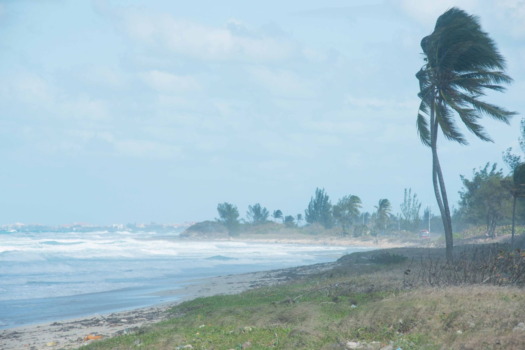

Be Prepared by Being Informed
Hurricanes are massive storm systems that form over ocean water and often move toward land. Hurricanes bring high winds, heavy rain, storm surge (rise in water level), flooding and tornadoes. These storms are dangerous and can cause damage to places far inland.
Prepare now so you can stay safe.
Hurricane Preparedness Checklist
