


Sept. 24, 2024 | 4 p.m.
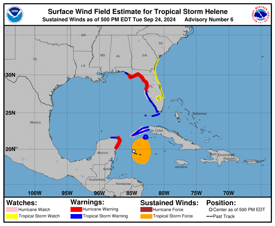
The 4 p.m. update from the National Hurricane Center on Tropical Storm Helene showed little change in the expected path of the storm, which is still trending toward Florida’s “big bend.”
The storm’s eye remains east of Santa Rosa County. The storm is expected to make landfall Thursday night, with the exact timing still to be determined.
Here’s part of the latest advisory from the National Hurricane Center.
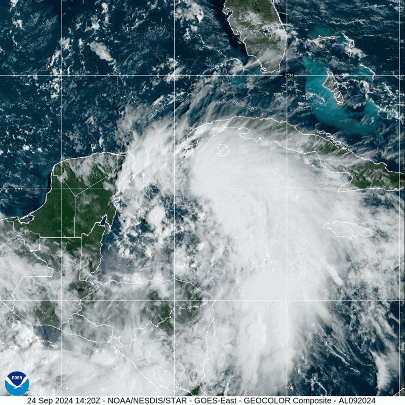
At 500 PM EDT (2100 UTC), the center of Tropical Storm Helene was
located near latitude 19.7 North, longitude 84.7 West.  Helene is
moving toward the west-northwest near 12 mph (19 km/h).  A turn
toward the northwest is expected tonight, followed by a general
northward motion beginning on Wednesday and continuing through
Friday.  On the forecast track, the center of Helene will pass near
the northeastern coast of the Yucatan Peninsula on Wednesday, move
across the eastern Gulf of Mexico on Wednesday and Thursday, and
reach the Big Bend coast of Florida late Thursday.

Maximum sustained winds have increased to near 50 mph (85 km/h)
with higher gusts.  Additional strengthening is forecast, and
Helene is expected to become a hurricane on Wednesday.  The storm
is forecast to rapidly strengthen over the eastern Gulf of Mexico
and become a major hurricane on Thursday.

Tropical-storm-force winds extend outward up to 175 miles (280 km)
to the east of the center.
Hurricane warnings and tropical storm warnings have been issued for areas to our east.
SUMMARY OF WATCHES AND WARNINGS IN EFFECT:

A Storm Surge Warning is in effect for...
* Indian Pass southward to Flamingo
* Tampa Bay
* Charlotte Harbor

A Hurricane Warning is in effect for...
* Anclote River to Mexico Beach, Florida
* Cabo Catoche to Tulum, Mexico

A Hurricane Watch is in effect for...
* Cuban province of Pinar del Rio
* Englewood to Anclote River, including Tampa Bay

A Tropical Storm Warning is in effect for...
* Dry Tortugas
* Lower and Middle Florida Keys west of the Channel 5 Bridge
* Flamingo to Anclote River, including Tampa Bay
* Rio Lagartos to Tulum, Mexico
* Cuban provinces of Artemisa, Pinar del Rio, and the Isle of Youth

A Tropical Storm Watch is in effect for...
* Lake Okeechobee
* Palm Beach/Martin County Line northward to the Savannah River